
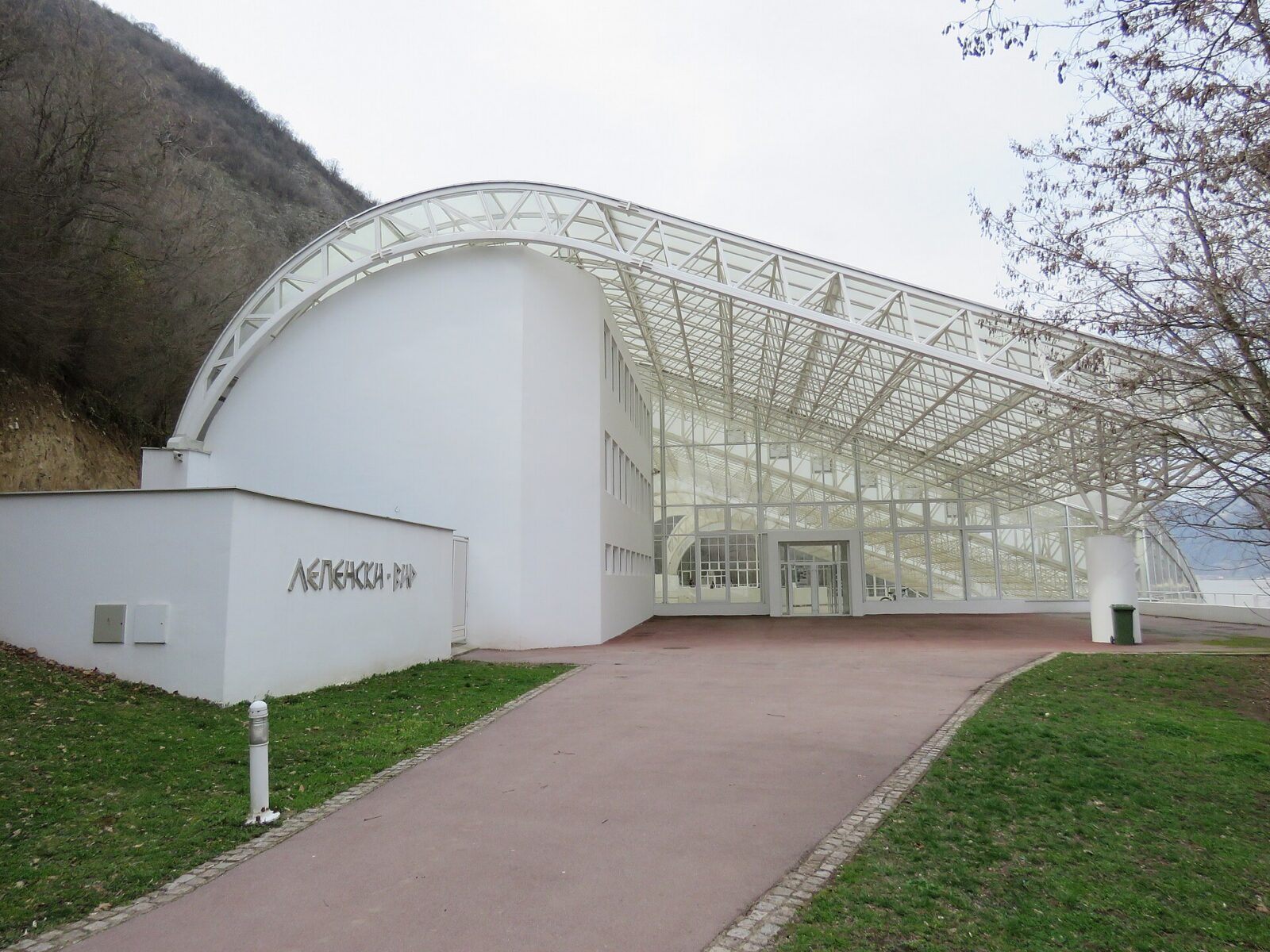
Lepenski Vir sits on a bend of the Danube where a fishing settlement, several thousand years old, would have vanished under a reservoir if nobody had moved it. Today its excavated houses and carved sculptures sit inside a shelter in the village of Boljetin, one of the four monuments Djerdap National Park lists as being of exceptional cultural significance, alongside Golubac fortress further upriver.
This page sets out how to actually get here, why neither the National Museum nor anyone else publishes a ticket price or an opening timetable for this particular site, and what the relocation in the early 1970s involved to keep the settlement above the water. It also covers something most guides skip past: three separate institutions, the museum that runs the site, the national park around it, and UNESCO, give three different date ranges for how old the settlement is, and none of them is obviously entitled to the final word.
Start with what you need to plan a visit: how to reach Boljetin, and why the price and hours you might expect from a museum are simply not published here. The relocation story, and the argument over the site’s age, follow after.
The short version. Lepenski Vir has been run by Belgrade’s National Museum since 1978, in a shelter that opened in June 2011 in the riverside village of Boljetin, near Donji Milanovac. The site was excavated in 1965-1970, then cut free, moved about 100 m northwest and raised 29.5 m in 1970-1971 to escape the reservoir behind the new Djerdap dam. Neither an admission price nor opening hours are published: call 030 501 501 or 030 501 389 before you drive out. How old the settlement is depends on who you ask: the museum gives 6300-5500 BCE, the park gives 7000-6000 BCE for its oldest layer, and UNESCO says simply “8,000 years”.
On this page
Getting to the Danube bank at Boljetin
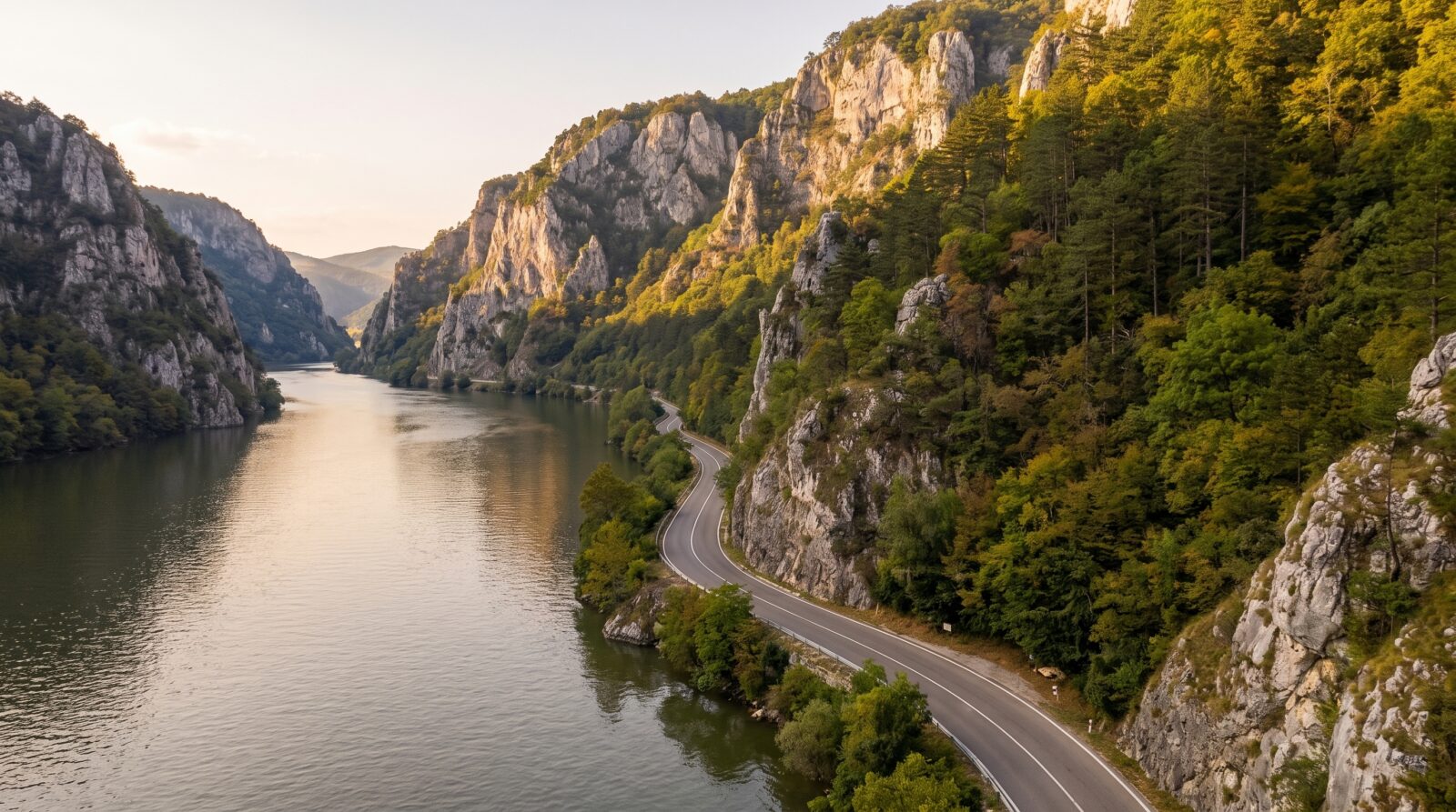
Lepenski Vir sits on the Danube’s bank in the village of Boljetin, close to Donji Milanovac. By your own transport, the National Museum’s own visitor page names three ways in: Corridor VII and the M25.1 highway between Belgrade and Kladovo, the Eurovelo 6 cycling route along the river, or arriving by boat.
That approach road is the same M25.1 corridor used to reach Golubac and the rest of Djerdap, so a stop here slots naturally into the same drive rather than a separate trip. No page from the museum names a scheduled bus or train reaching Boljetin directly. Only phone and email booking lines for group and school visits are given, consistent with a site that expects you to arrange your own way there: the road, the cycling route or the river, with no coach pickup or shuttle mentioned anywhere.
The National Museum has run Lepenski Vir since 1978, and its current shelter, doubling as the visitor centre, opened in June 2011. Renting a car in Serbia covers what driving yourself involves, and planning eastern Serbia from Belgrade weighs that against an organised circuit.
Why there’s no published price or opening hours
The National Museum publishes full prices, hours and a weekly closing day for its four other venues on the same visitor page. For Lepenski Vir, that page gives only a how-to-reach-us block and group-booking phone numbers: no ticket price, no timetable, no stated closing day, and no word on whether an individual visitor needs a guide.
That is a different approach from Golubac and Uvac, covered elsewhere on this site, where the operators publish detailed price tables down to child and pensioner rates. Lepenski Vir is run by a museum rather than a standalone visitor operation, and its published priorities plainly sit with its four other venues, not this one.
It also means the advance-notice rule that governs Djerdap’s own hiking trails does not apply here in the same form: Lepenski Vir sits inside the park’s boundary but is run by the National Museum, not the park administration, so a different institution, with different habits of publishing, is the one you need to reach before you go.
Call 030 501 501 or 030 501 389 before you drive out. An unpublished price is not the same as free entry, and a site with no stated hours is not necessarily open whenever you arrive. The absence just means the museum has not put a number on either one, and it is the one detail this page cannot hand you.
Moving a Stone Age settlement to escape a dam
Excavating before the reservoir rose
Archaeologists excavated Lepenski Vir between 1965 and 1970, part of the wider Djerdap I project that also built the dam covered on this site’s Djerdap National Park page. The dig was a joint effort: the National Museum in Belgrade, the Archaeological Institute, the Republic Institute for the Protection of Cultural Monuments, its Nis counterpart, and the Faculty of Philosophy’s Centre for Archaeology, led by Dragoslav Srejovic.
Lifting the site 29.5 metres in 1970 and 1971
The excavated site sat in the zone the new reservoir was about to flood, so it could not simply stay where archaeologists found it. In 1970 and 1971, the Republic Institute for the Protection of Cultural Monuments, led by Milka Canak-Medic, cut the remains free, moved them about 100 m to the northwest, and raised them 29.5 m above their original position. The movable finds have been kept since their discovery in the National Museum’s own Lepenski Vir Collection in Belgrade.
Downstream in the gorge, Trajan’s Tablet faced the same threat from the rising reservoir and was saved a different way: cut out and reset higher on its cliff rather than moved. Lepenski Vir’s houses and sculptures could not be lifted in place like a single stone tablet, so engineers relocated the whole settlement instead.
How old is Lepenski Vir? Three institutions disagree
The museum’s dates: 6300 to 5500 BCE, and “9000 years”
The National Museum, custodian of the site since 1978, states that Lepenski Vir was intensively inhabited from 6300 to 5500 BCE. Elsewhere on its own site, it calls the relocated settlement “9000 years old”, a round, popular figure that does not line up with that calendar range.
The park’s two layers: sculptors, then farmers
Djerdap National Park’s own page gives a different picture. It dates the finds, sacred architecture and monumental sculpture that made the site famous to 7000-6000 BCE, describing seven successively built hunter-fisher-gatherer settlements found one on top of another. A later layer of farmers and herders, built over that sequence, is dated separately to 5300-4800 BCE.
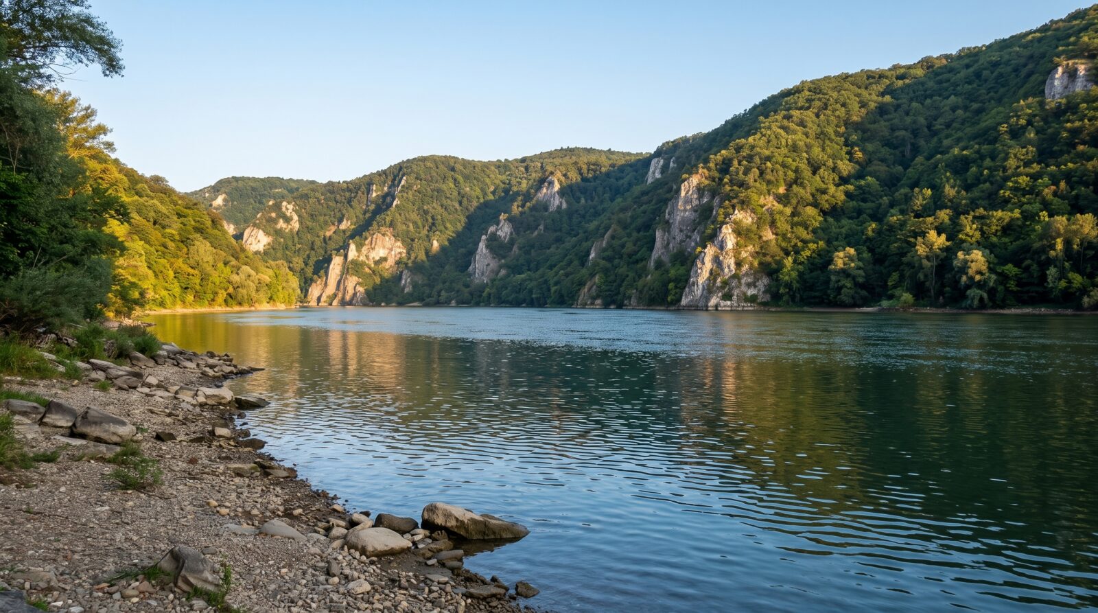
UNESCO’s own page on the wider Djerdap geopark adds a third figure, saying simply that the site “dates back 8,000 years”, without giving a calendar range at all. The three do not reduce to one number: which sub-period each institution means is not stated clearly enough to reconcile them, so this page reports the disagreement rather than picking a winner.
If you come across a single figure elsewhere, a tour listing, a plaque photographed and shared online, treat it as inheriting one of these three ranges rather than as an independent finding. Reporting the disagreement here means not pretending a settled consensus exists where none does.
Walking through the sculptures on display
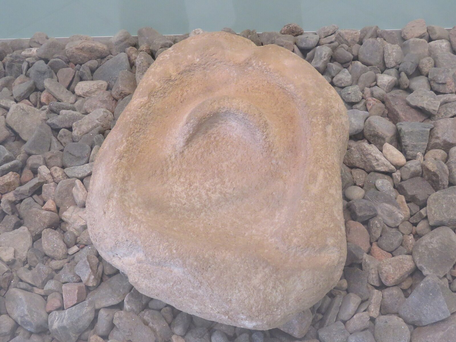
The most famous finds at Lepenski Vir are sculptures and altars carved from coarse-grained sandstone river boulders, found set into lime-mortar house floors, usually next to the hearth. The National Museum splits them into two kinds: figural sculptures, which show a human likeness, and ornamental ones, decorated with meander, fishbone and plait motifs.
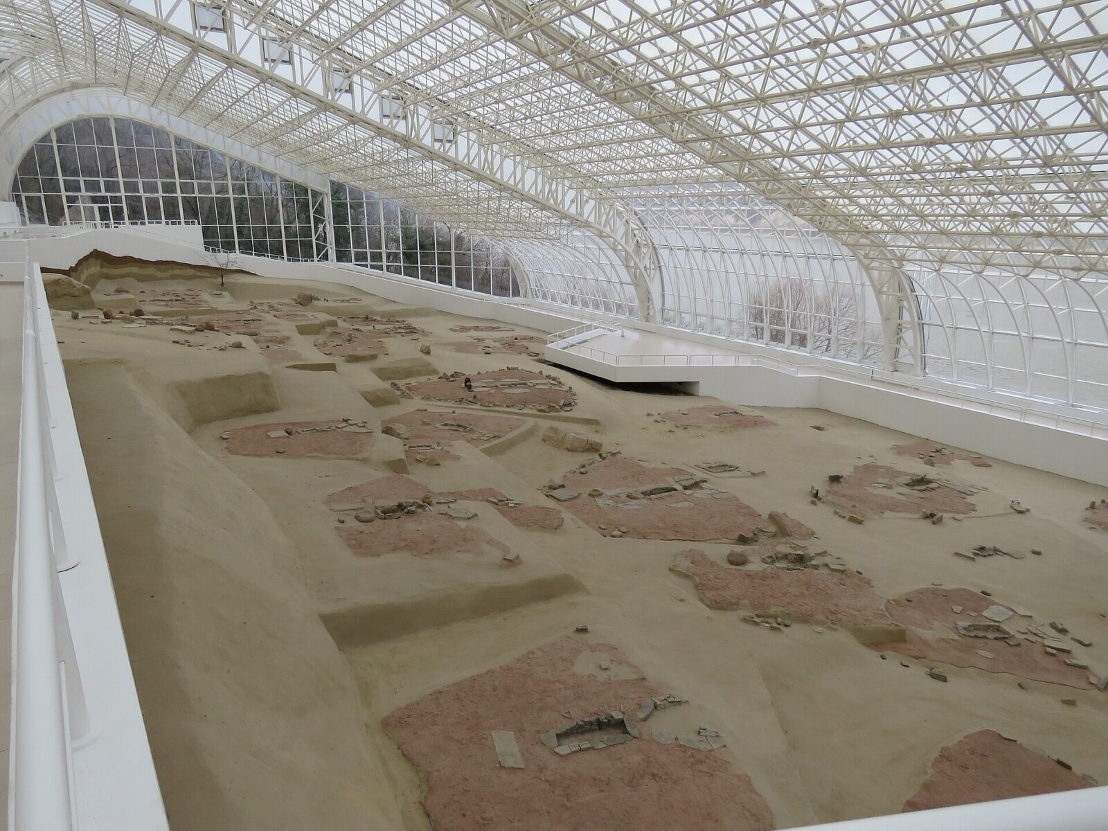
Inside the shelter, the site itself is the main exhibit: copies of the monumental sculptures sit where the originals were found, alongside more than 100 further items, including tools, jewellery, altars and Neolithic pottery, a reconstruction of burial practices, and a holographic reconstruction of the settlement’s houses. Because the shelter places these copies exactly where excavation found them, walking through it follows the footprint of the original settlement rather than a curated gallery sequence.
What the record leaves open
Djerdap National Park’s own page counts seven successively built settlements of hunter-fisher-gatherers at Lepenski Vir, layered one on top of another. That is a count of settlement phases, not of individual houses within them, and neither the park nor the National Museum gives a total number of houses uncovered. We are not filling that gap with a figure taken from elsewhere.
Whether you can photograph inside the shelter is not stated specifically for this site either. The museum’s network-wide code of conduct allows photography without flash, but that page is written for teachers organising school visits across all of the museum’s branches, not for individual visitors at a fragile in-situ site under a shelter roof. Ask at the desk before you start shooting.
No museum page states whether the shelter itself is ever closed for maintenance, flooding or other technical reasons. The museum’s main Belgrade venue publishes a weekly closing day and a free Sunday slot; neither detail is repeated for Lepenski Vir, so do not assume either one applies here.
None of these gaps means something is being hidden. They are simply areas where the museum and the park, both otherwise detailed about their own areas of expertise, have not published a specific answer.
Sitting inside a park of four monuments
Lepenski Vir is one of exactly four monuments Djerdap National Park lists as being of exceptional cultural significance, alongside Golubac fortress, Trajan’s Tablet and the Roman camp of Diana Karatas, under the park’s own 2013 Spatial Plan. The same inventory counts eight registered immovable cultural assets and eleven further recorded ones inside the park, a longer list sitting beneath the four headline sites Lepenski Vir belongs to. The other three sit further along the same stretch of the Danube, and the park that holds them all together is covered on its own page.
Golubac fortress, at the park’s western entrance, pairs naturally with a visit here, and the wider Djerdap National Park page covers the gorge, its fees and its trails.
Common questions
How much does it cost to visit Lepenski Vir?
Not published. The National Museum lists prices for its other venues but gives none for Lepenski Vir. Call 030 501 501 or 030 501 389 to check before you go.
How do I get to Lepenski Vir without a car?
No scheduled bus or train is named by the museum. The Eurovelo 6 cycling route runs along the river, and arriving by boat is stated as an option, but the museum’s own page assumes you are arranging the journey yourself.
How old is Lepenski Vir, really?
It depends which institution you ask. The National Museum gives 6300-5500 BCE for intensive occupation, Djerdap National Park gives 7000-6000 BCE for its oldest sculptural layer and 5300-4800 BCE for a later farming layer, and UNESCO simply says “8,000 years”. None of the three is treated here as the final word.
Can I take photos inside the shelter?
Probably without flash, based on the museum’s general code of conduct, but that rule is written for school visits across all its branches rather than for individual visitors at this specific site. Ask on arrival rather than assume.
Was the site always in this exact spot?
No. It was excavated between 1965 and 1970, then cut free, moved about 100 m to the northwest and raised 29.5 m in 1970 and 1971, to keep it above the reservoir created by the new Djerdap dam.
Can I combine Lepenski Vir with Golubac fortress in one day?
Both sit along the same M25.1 corridor through Djerdap, so a single drive can take in both. Neither this page nor the Golubac page has a verified drive time between the two, so check a map and build in time for the advance call to Lepenski Vir before you commit to the plan.
Nearby
Lepenski Vir sits along the same stretch of the Danube as the rest of Djerdap, so it folds easily into a wider trip. Djerdap National Park covers the gorge, its fees and its trails, and Golubac fortress marks the park’s western entrance. Planning eastern Serbia from Belgrade weighs a self-driven route against an organised circuit, and renting a car in Serbia covers what driving here involves before you commit. For more of the region beyond a single site, browse day trips from Belgrade.