
Tara is where western Serbia turns into forest, then drops straight down to the Drina and the border with Bosnia and Herzegovina. Somewhere between the trees and the river sits Banjska stena, the viewpoint that ends up on most Serbian postcards, and further along the water a small wooden house balances on a rock in the middle of the current. The mountain around both of them has been a national park since 1981.
This page sets out what the park charges before it lets you in, how to reach Banjska stena while its trail signs are down, and what its own rules do and do not cover once inside. The Drina comes next: Lake Perucac, the house on the rock, and the boat trips neither the park nor the local tourist office will name an operator for.
History and status come last, because you are more likely to be packing a bag than reading about a 1981 decree. Tara’s own numbers, its three protection zones and its one endemic tree are still worth the few paragraphs it takes to get through them.
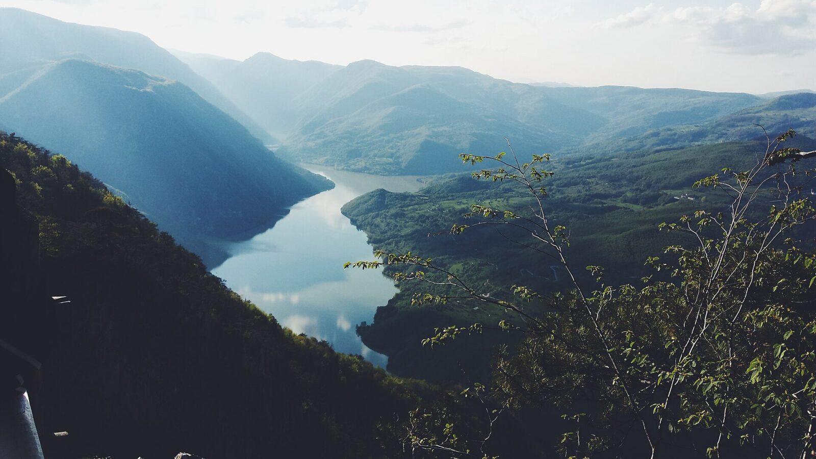
The short version. Tara National Park charges 100 RSD a person per day, 50 RSD for ages 7 to 18, plus 300 RSD a day for a car; specific spots including its viewpoints add 250 RSD. Banjska stena, the showcase viewpoint over Lake Perucac and the Drina canyon, sits 6 km from Mitrovac; the park’s own trail signage has been taken down while the network is rebuilt, so carry a downloaded track rather than trust a post. Kucica na Drini, the wooden house on the rock, is seen from the bank or a passing boat, never entered. Neither the park nor the local tourist office names a boat operator, and the park’s published rules say nothing about drones or swimming, in either direction.
On this page
What you pay to use the park
A day inside Tara National Park costs 100 RSD a person, or 50 RSD if you are between 7 and 18, under the use-charge decision the park’s management last signed on 25 March 2025. Specific spots, including its viewpoints, gorges and caves, add another 250 RSD per person, cut to 150 RSD each for a group of more than ten. Bringing a car or a motorcycle costs 300 RSD a day, 800 RSD for ten days, or 2,000 RSD for a year.
| Charge | Amount |
|---|---|
| Per person, per day | 100 RSD (50 RSD, ages 7 to 18) |
| Viewpoints, gorges and caves | 250 RSD per person (150 RSD in groups over ten) |
| Car or motorcycle, per day | 300 RSD (800 RSD for 10 days, 2,000 RSD for a year) |
You pay a warden at one of the entry points, or settle it beforehand through the park’s own online portal by entering your number plate. The decision setting these charges carries no expiry date, so treat the figures above as the latest the park has published rather than a guaranteed 2026 rate, and keep a little cash handy in case the portal is not an option at the crossing point.
Getting here from Belgrade
The park’s own directions page lists an asphalt road from Belgrade via Valjevo as one way in, alongside a longer route through Cacak, Uzice, Kremna and Mokra Gora toward Visegrad, which passes close to Zlatibor. It also lists routes from Novi Sad via Sabac and Loznica, and from Nis via Krusevac, Kraljevo, Cacak and Uzice, plus a direct Raketa AB coach running several times a day from Belgrade to Bajina Basta and on to Tara and Perucac. Beyond its own forest roads, the park runs no public transport of its own.
The park calls its own directions purely indicative. Its directions page states outright that everything on it is informational only, and gives a phone number, 031/865-485, for confirming a route or a coach time before you rely on it. Treat the roads and the coach above as a starting point for planning a trip, not a timetable to build one around.
Renting a car makes those routes far more flexible than waiting on a single daily coach, especially if you also want to reach Banjska stena or Lake Perucac on your own schedule. Renting a car in Serbia covers what that takes, from paperwork to border crossings.
Getting to Banjska stena
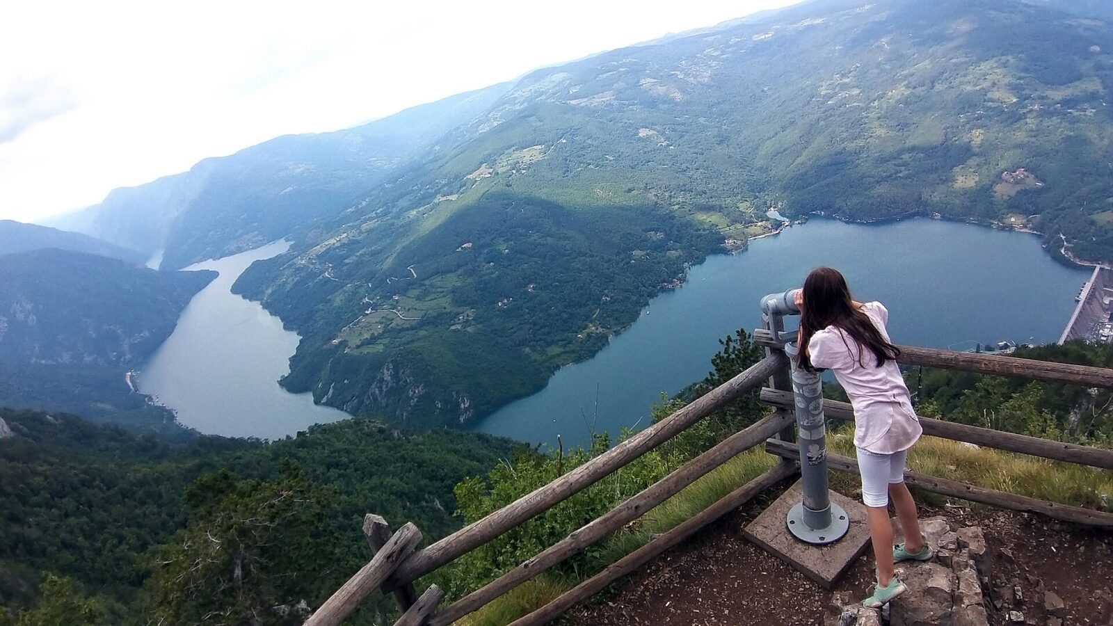
Banjska stena is the viewpoint everyone means when they say they are going to Tara. The park’s own page describes it as one of five fenced, equipped viewpoints in the reserve, sitting 6 km from Mitrovac at 1,065 m, with Lake Perucac, the Drina canyon and the Osat area of Bosnia laid out below it. That page carries no date, so treat the altitude and the distance as what the park currently publishes rather than a fixed, surveyed constant.
Getting there on foot means trail 09 or 09a out of Mitrovac. The park’s own trail-signage notice adds a third option, trail 20 from Sedaljka, while its viewpoints page mentions only the first two, a small inconsistency between its own pages. A macadam road from Mitrovac reaches the same spot if you would rather not walk it.
Don’t count on a signpost. The park’s own walking page states that its trail network is under reconstruction and that directional signage has been taken down, leaving only standard waymarks in place; it recommends downloading its GPX tracks and following them on a phone instead. That page carries no date, so there is no way to know how long this has been the case or when it might change. Across the park as a whole it lists 290 km of marked routes. Load a track before you set out rather than plan around signs that may no longer be there.
What the park doesn’t spell out
Tara National Park publishes one page of behaviour rules, undated like several of its visitor pages. Camping is allowed only in designated areas, and lighting a fire only in the spots set aside for it. Picking or damaging any of the park’s rare and protected plants is forbidden outright, and gathering medicinal plants or forest fruit needs a special permit, as does any commercial photography or filming. Staying on marked trails and roads is presented as a rule, not a suggestion.
The same page says nothing about drones or swimming. That rules page is the only place the park sets out a code of conduct, and neither a drone nor a swim gets a mention, in either direction. That silence does not clear either one: it just means the park has not published a position, so ask a warden on the spot before you fly one or wade in, rather than assume an absent rule means permission.
What formed Lake Perucac
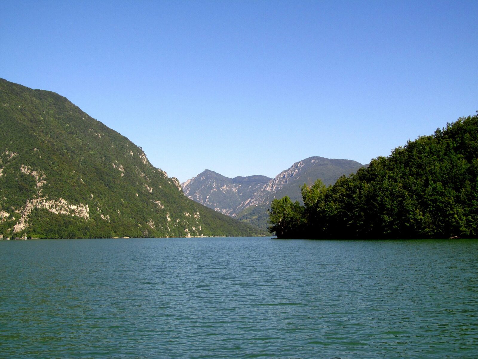
Lake Perucac is not a natural lake: it formed when a dam went up on the Drina for the Bajina Basta hydroelectric plant. The reservoir covers about 12.4 sq km, holds around 340 million cubic metres of water, reaches a depth of 60 m in places, and stretches roughly 54 km along the river, narrowing to as little as 150 m in its gorge section. It sits at 290 m altitude, well below the park’s own highest ground.
The local tourist office describes a public beach at Perucac with pontoons, lifeguards on duty, and boats or pedalos for hire, plus a canyon cruise running upstream toward the Mehmed Pasa Sokolovic bridge at Visegrad. It names no operator or price for either the cruise or the hire boats, so arrange it locally once you arrive rather than book from home.
The park’s boat rules are stricter than the beach makes them sound. An undated page of park regulations states that any boat or floating installation on its reservoirs needs the operator’s written permission, bans engines over 20 hp except for licensed passenger-transport operators, rules out jet-skis and personal watercraft outright, and stops navigation after dark or in poor visibility. It does not name Lake Perucac specifically, but the reservoir falls under the park’s general rules for its hydro-accumulations, so the hire boats and pedalos advertised at the beach are presumably operating with that permission already granted. Nothing on either site confirms that link directly, so anyone bringing their own boat should ask the park before launching it.
What you can see of Kucica na Drini
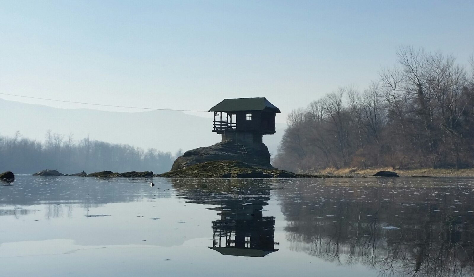
Kucica na Drini is the small wooden house already familiar from countless photographs, perched on a rock in the middle of the river. It is not a building you walk into. The local tourist office describes it purely as something to be seen from the riverbank or from a passing boat or raft, and singles out the annual July Drina Regatta as an event that passes right by it. The Drina has swept the house away more than once over the decades, and each time it has been rebuilt.
No official visit operator or boat company is named for it, by the tourist office or by anything else checked. Getting close on the water rather than photographing it from the bank means asking around in Bajina Basta on arrival, not booking a ticket in advance.
How Tara became a national park
Declared in 1981
Tara became a national park on 13 July 1981, a designation covering almost 25,000 hectares across most of the Tara and Zvijezda mountain massif, right up to the border with Bosnia and Herzegovina. Its highest point, Kozji rid, reaches 1,591 m, and the park’s average altitude sits between 1,000 and 1,200 m.
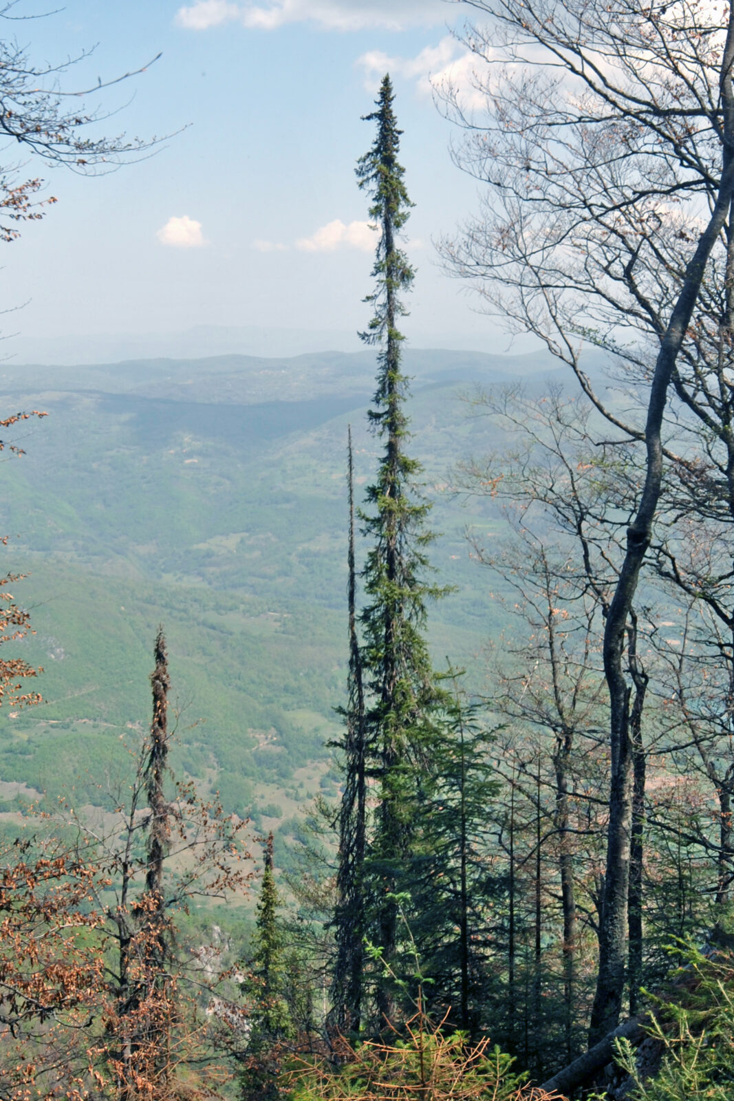
Part of the reason for that 1981 designation was the mountain’s population of Pancic spruce, an endemic conifer that survived the last ice age and grows naturally nowhere outside this part of the Balkans. A separate, undated page on the park’s own site notes that a good number of these trees have died back over the last decade, attributing it to climate change; take that as colour from the park rather than a measured figure, since the page carries no date.
Three zones, one park
The park’s own site gives a more exact figure for its protected area: 24,991.82 ha, split into three protection degrees. Zone I, the strictest, covers 3,323.92 ha, or 13.35 percent, taking in nature reserves, protected cultural assets and natural monuments. Zone II covers 8,514.39 ha, 34.07 percent, and the remainder of the park sits in zone III, the least restricted tier. That page carries no date either, though its figures line up closely with the rounded, almost-25,000-hectare figure published elsewhere on the park’s own site.
Common questions
How much does it cost to enter Tara National Park?
100 RSD a person per day, 50 RSD for ages 7 to 18. Specific spots including viewpoints, gorges and caves add 250 RSD per person, or 150 RSD each in a group of more than ten, and a car or motorcycle costs 300 RSD a day. Pay a warden at the entry points or settle it in advance through the park’s own online portal.
Can I trust the trail signs at Tara?
Not right now. The park’s own walking page says its trail network is being rebuilt and that directional signage has been taken down, leaving only standard waymarks. It recommends downloading a GPX track and following it on your phone instead of looking for a post.
Can you go inside Kucica na Drini?
No. The local tourist office describes it as something seen from the riverbank or from a passing boat or raft, not a building you enter. No visit operator or boat company is named for it anywhere we found.
Are drones or swimming allowed in the park?
The park’s published rules page does not say, for either one, in either direction. That is a silence, not a permission and not a ban, so ask a warden before you fly a drone or go in the water.
How do I book a boat trip on the Drina or Lake Perucac?
Neither the park nor the local tourist office names an operator, a price or a timetable for the canyon cruise toward Visegrad or for hiring a boat or pedalo at the Perucac beach. Ask locally once you arrive rather than trying to book ahead.
Is Banjska stena reachable by car?
The park’s page on its viewpoints mentions a macadam road from Mitrovac reaching Banjska stena, alongside trails 09 and 09a on foot. That page is undated and does not mention parking or a fee specific to the viewpoint itself.
Nearby
Tara sits within reach of several other stops on this side of Serbia. Mokra Gora, with the Sargan Eight railway and Drvengrad, is on the same road toward Visegrad. Zlatibor works well as a base for the wider area, including Tara, if you would rather not change accommodation every night. Uvac, further south, adds a second river canyon and viewpoint circuit to the same trip. For the wider itinerary these pieces fit into, see Serbia in 7 days, and for driving yourself between them, renting a car in Serbia covers what that involves.